
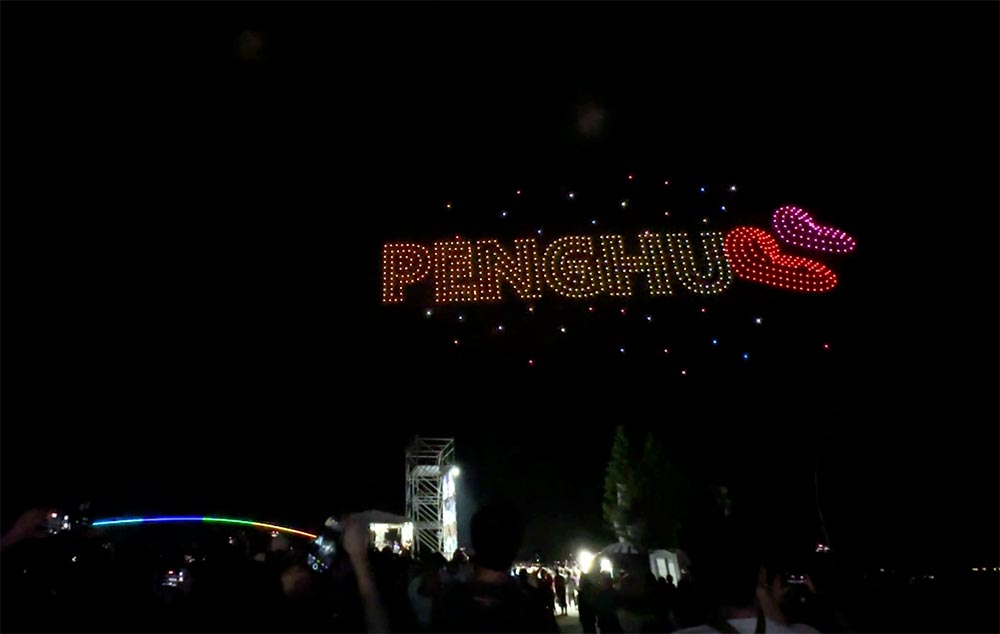
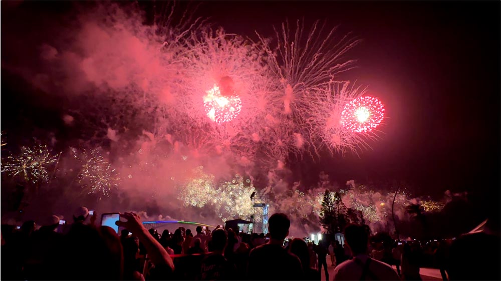
Visiting Taiwan‘s Penghu Islands solo? It’s not difficult for you to get around to see the sights independently by driving or on scooter. I visited the Penghu islands in May over the famous Penghu Fireworks Festival season and put together this 3-day Penghu itinerary with my recommendations on things to do in Penghu for fellow solo travellers.
If you’re planning a trip to Penghu, check out my Penghu planning post with more details on how to get to and getting around the islands. This post focuses more on what to see in Penghu in a 3 day itinerary. You can also check out some of my favourite Penghu hidden gems.
How long to spend in Penghu?
Penghu is the largest of Taiwan’s offshore islands and really is a archipelago of 90 islands, not one single island.
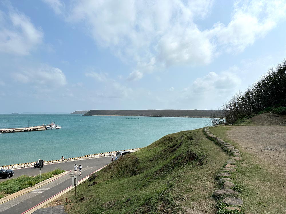
The bulk of tourists will spend time in Penghu’s main island where Magong City is because that’s where its main infrastructure, the Penghu airport and the main ferry terminal are located. Penghu is also connected by land to 3 other islands so you can see all that without having to take another transfer.
I spent 4 nights in Penghu, flying in on a Monday late afternoon and flying out on Friday morning. This gave me 2 nights to experience the Penghu fireworks festival on Monday and Thursday nights, and the chance to do a day trip to the southern islands of Qimei and Wang’an.
I recommend spending a minimum of 3 days to cover the main sights in Penghu and do a day trip to one of its further islands. Of course with more time to spare you can see more of the other smaller islands in Penghu and have a more leisurely time overall, but minimally 3 full days of activity would be ideal.
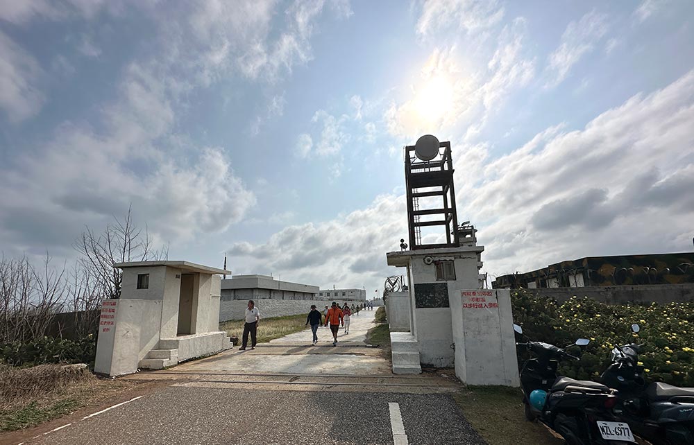
Day 1: Baisha + Xiyu 白沙 + 西嶼
Penghu’s main island of Magong 馬公 is connected by roads to Baisha 白沙 to the north, which is then connected to Xiyu 西嶼 which curves back down towards the west of Magong.
If you drove along this road without stopping at all it should take about 50 minutes to get to the far end of Xiyu, but with all the stops you’ll want to make along the way, it should take the whole day to see the sights along this stretch.
Baisha is about 15 minutes drive north of Magong’s Nanhai Harbour.
Baisha 白沙
Zhongtun Wind Turbines 中屯風車
The first thing you’ll notice as you cross the bridge to Baisha are the giant wind turbines located near the bridge. This is just one of the signs of how absolutely windy Penghu is, something you’ll hear me talk about repeatedly because it truly is. You feel the wind especially along these connecting bridges and being blown about while on a little scooter.
I parked my scooter here for a bit and took a walk down the road to the base of the windmills just for a quick looksee around the area, but there’s not much out here.
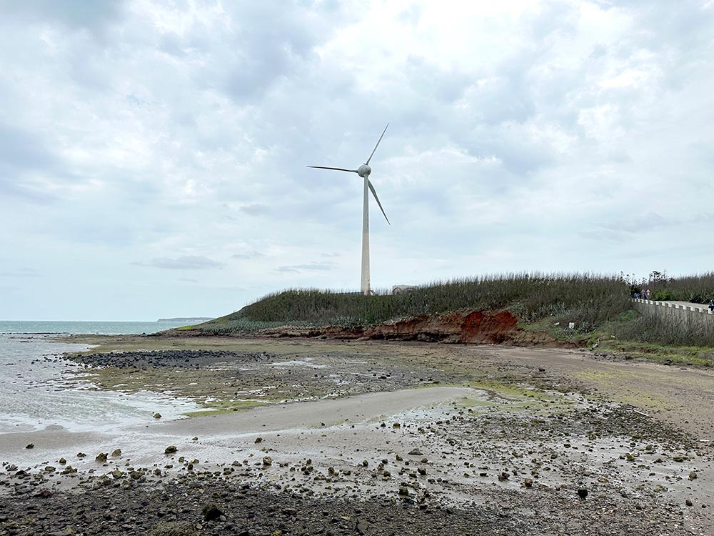
Zhongtun Wind Turbines 中屯風車 (Zhong Tun Feng Che) [Google maps]
Houliao Paradise Road 後寮天堂路
Houliao Paradise Road used to be one of those secret Instagram spots, a little winding jetty that sticks out into the sea that makes for perfect little pictures. It’s definitely not a secret these days, and you’ll see lots of signs pointing you in the right direction as you enter Houliao Village.
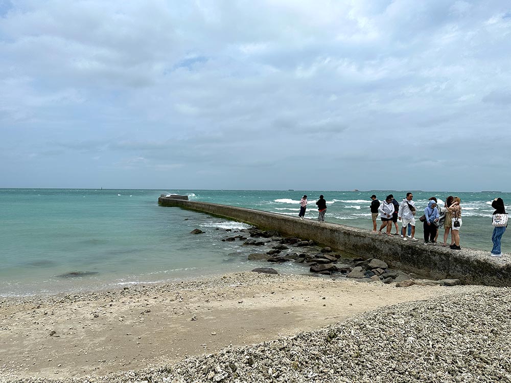
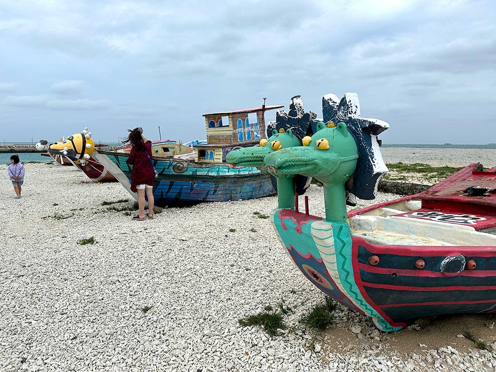
I drove in and entered first at Houliao Wharf and beach where there were some colourful boats on display along with a convenient toilet, but found another road that led me eastwards to another part of the beach where you can see the Paradise Road a short walk away.
Now weather is a key thing in outdoor places like Penghu, and that day I visited winds were particularly high and the sky was pretty overcast. I did walk over to the road but those waves were choppy as hell, splashing up onto the road. There are no barriers on the paradise road so if a particularly strong wave comes along, you better hope you don’t get swept off! I decided not to rick it and just enjoyed the view from the beach, though lots of people did take their pictures on the road, most chose not to venture out towards the end for safety.
This beach is made up of coral bits so it gets a bit poky! Definitely don’t fall down here.
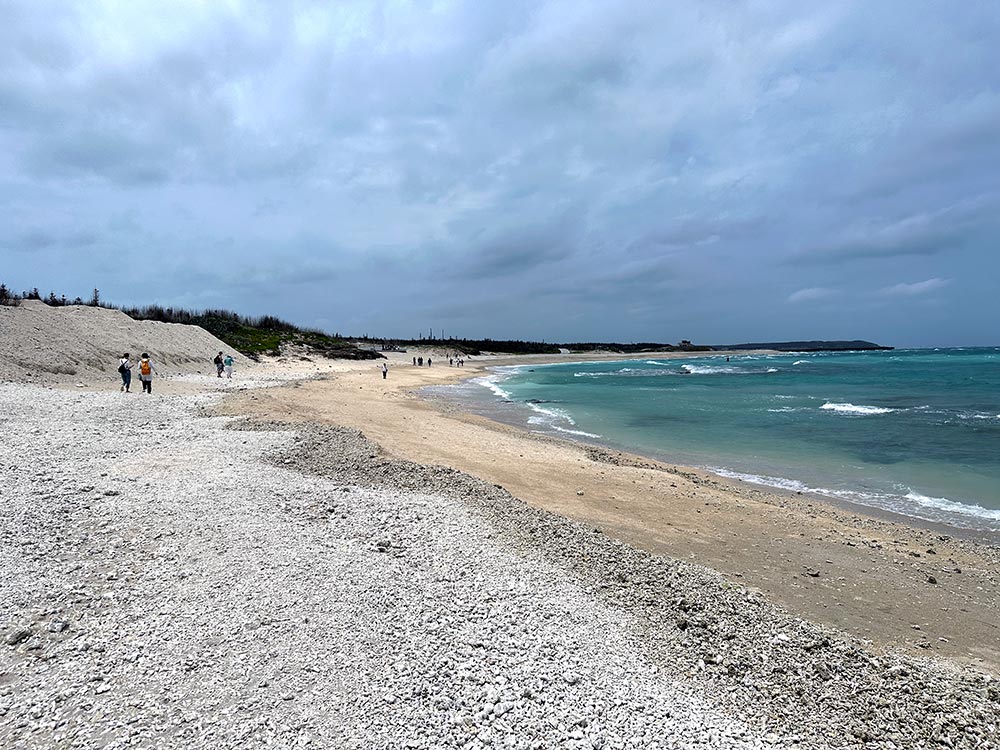
Houliao Paradise Road 後寮天堂路 (Hou Liao Tian Tang Lu) [Google maps]
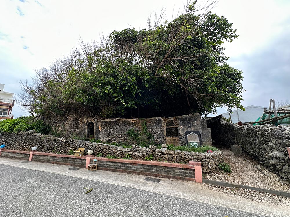
Tongliang Great Banyan 通樑古榕
Right before the Penghu Great Bridge, you can turn off into the village to look for the Tongliang Great Banyan, which is a huge Banyan tree whose roots have completely overgrown and taken over the Bao’an temple here.
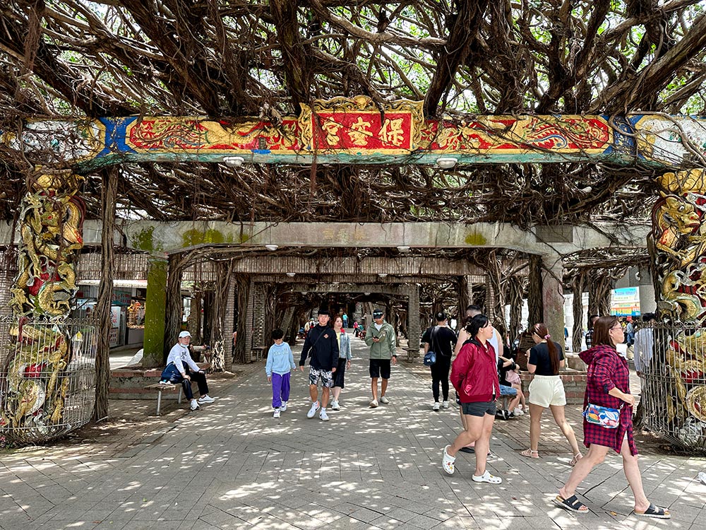
This tree is apparently over 300 years old and is considered sacred, and the local authorities have also designated it as the official county tree because of its hardiness and resilience.
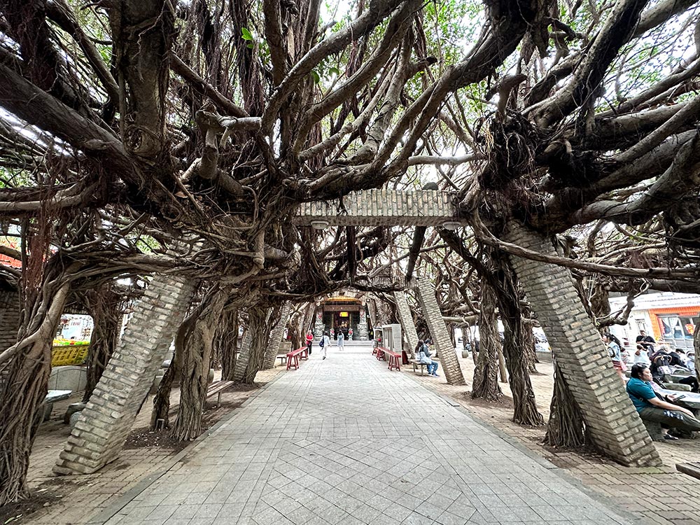
Penghu is pretty fond of the overgrown Banyan tree, you can see another version in Nanliao Village as well.
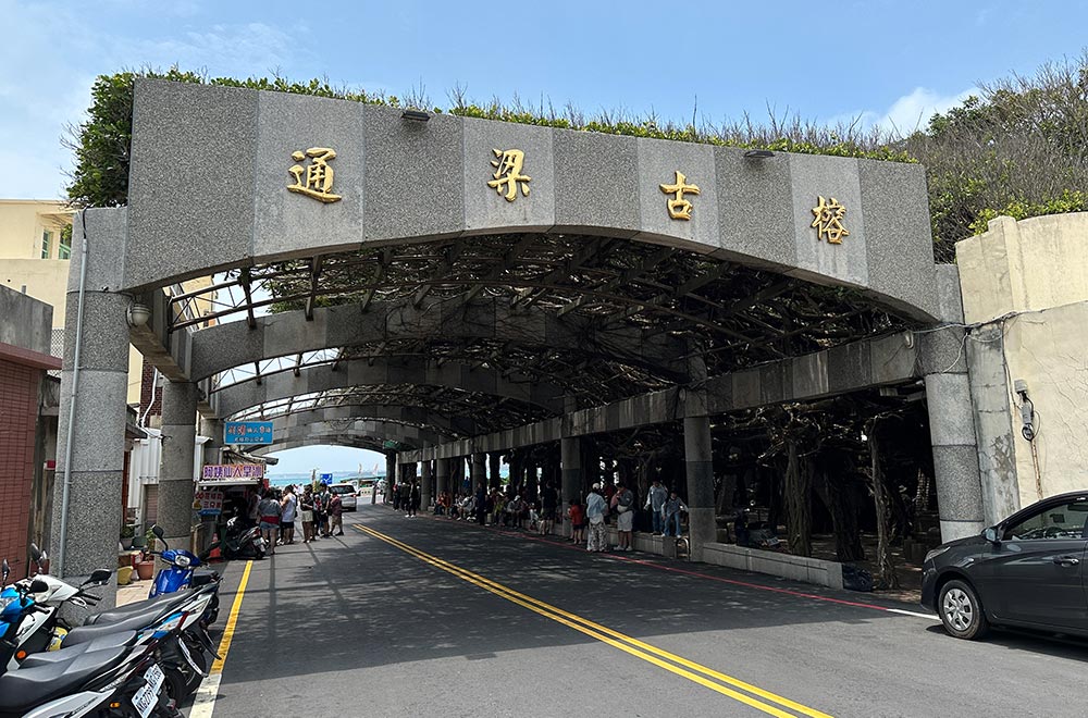
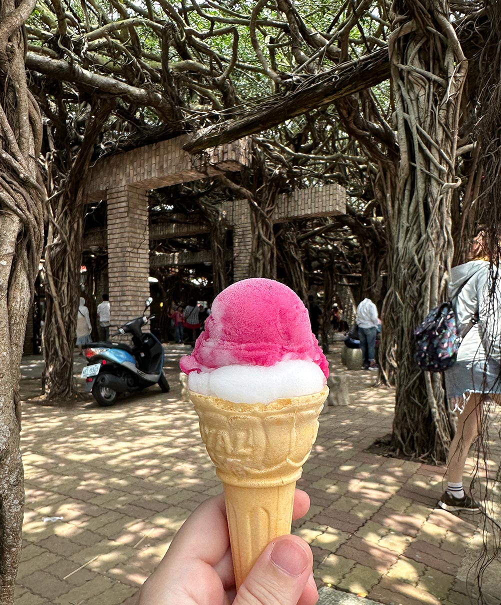
It’s nice and shady underneath the roots of the Banyan but other than have a look or pray at the temple, there’s not much else to do here. There are a bunch of little food stalls though so it’s not a bad place to stop for a break and snack. Yummy cactus ice cream that Penghu is famous for can be found here!
Tongliang Fishing Harbour is also located here and has a nice photogenic little arch bridge to walk over.
Tongliang Old Banyan Tree 通樑古榕 (Tong Liang Gu Rong) [Google maps]. The temple is open 24 hours but the nearby shops are typically open around 8am-5pm.
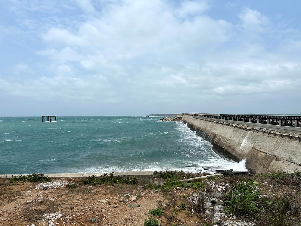
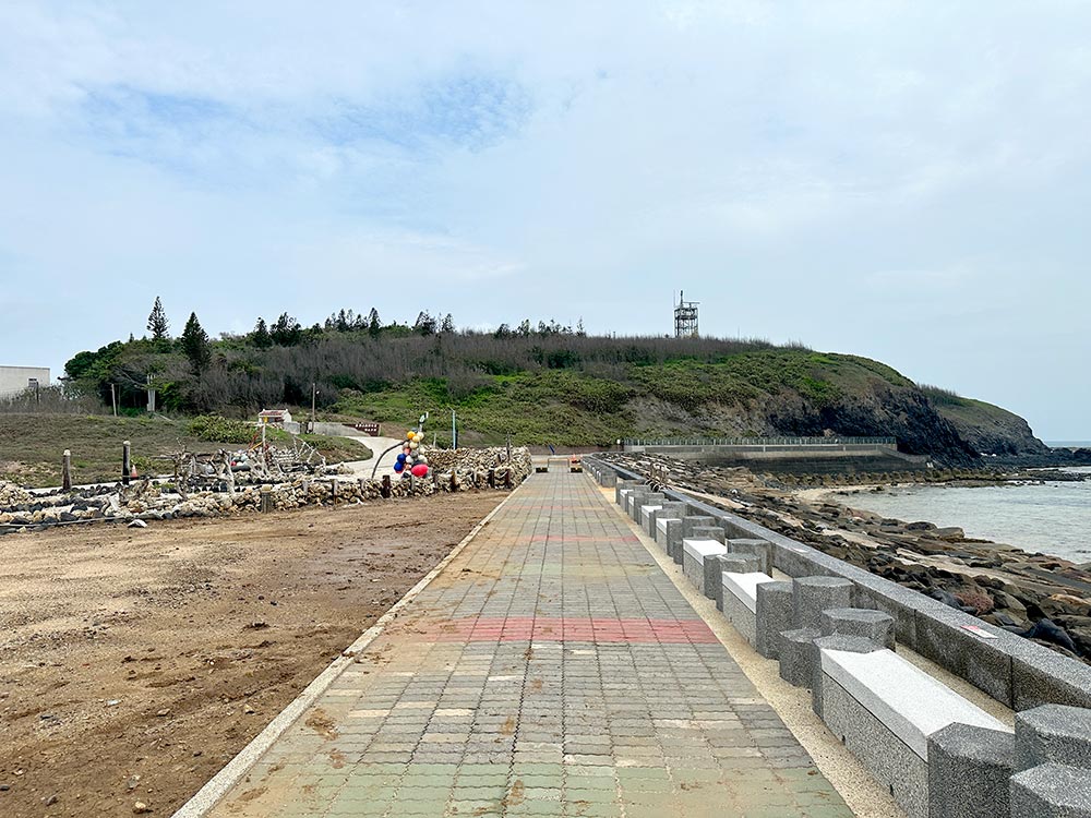
Penghu Great Bridge 澎湖跨海大橋
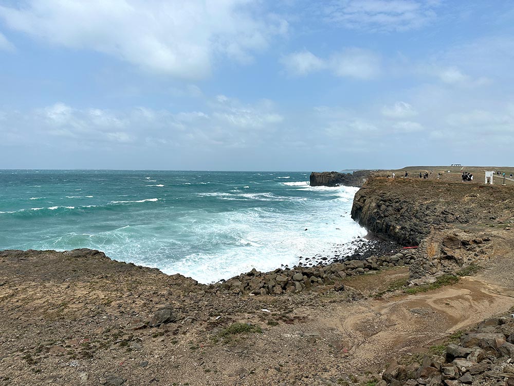
One of Penghu’s icons is the Penghu Great Bridge which joins the islands of Baisha and Xiyu. Also known as the trans-ocean or Kuahai 跨海 bridge, it’s about 2.5km long! Again, another very windy spot where you will need to make sure that you don’t get too blown about if you’re on a scooter.
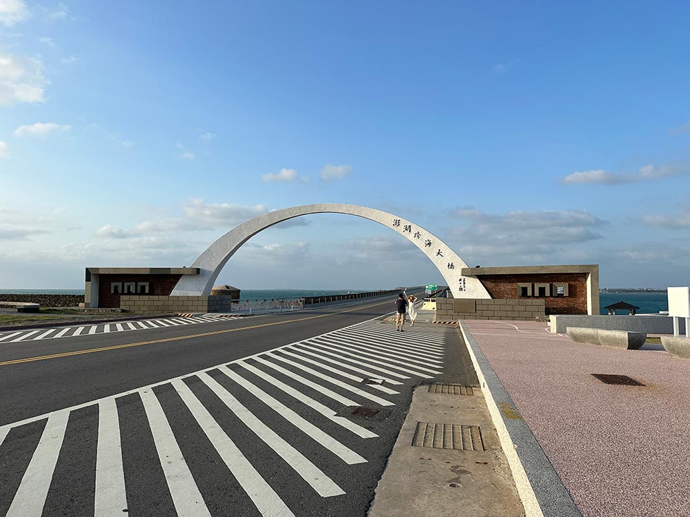
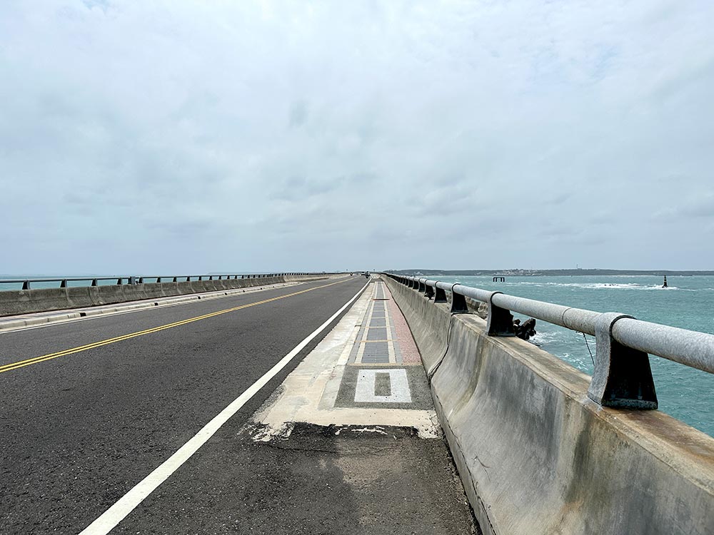
Next to this great bridge you can see some remains of the old bridge that used to link the islands.
Penghu Great Bridge 澎湖跨海大橋 (Penghu Kua Hai Da Qiao) [Google maps]
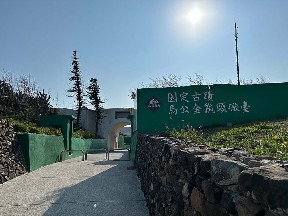
Xiyu 西嶼
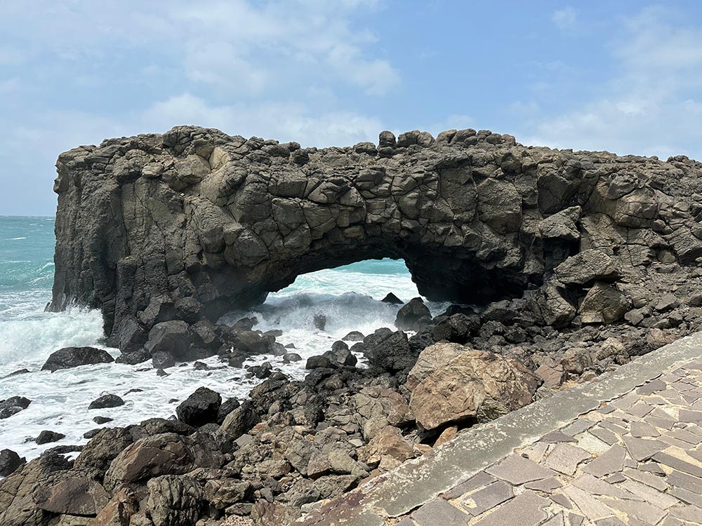
Whale Cave 鯨魚洞
Strictly speaking, Whale Cave is located on another island connected to the north of Xiyu called Xiaomen 小門嶼 or Shomon Island. There is a main parking area, and from there you walk around to see the sights of this tiny islet.
The highlight of course is the Whale Cave, which is really more of an arch in the basalt rock that supposedly looks like a whale from afar than an actual cave. The waves were really pounding the rock when I visited so again, I didn’t go too close.
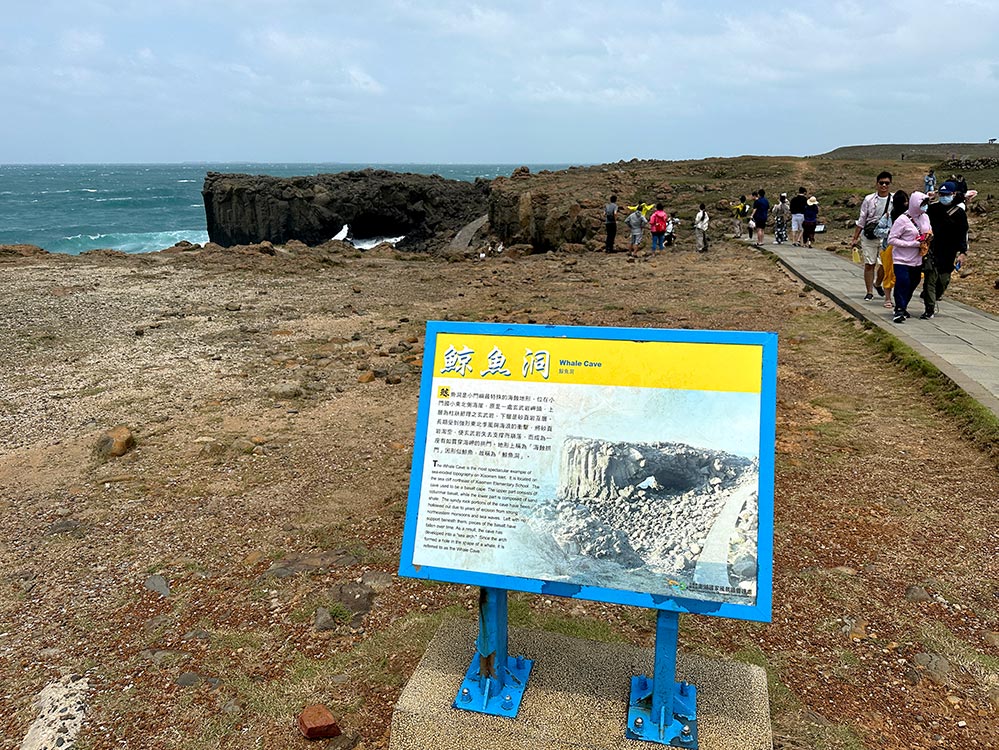
The rest of the islet is often described as a mini Penghu – super flat grasslands with no trees and plenty of coastal views. A tiny little path circles the islet and will bring you back to the starting point, but I didn’t bother walking it since the weather wasn’t so great. There is a Geology Gallery here as well, but I didn’t bother going in.
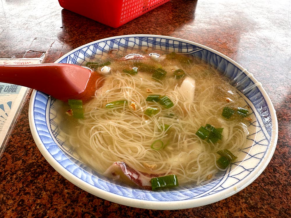
Instead, I headed for some food and ate at this little restaurant called 秀鳳姐的店 or Xiufeng Sister’s shop [Google maps]. Another of Penghu’s must eats is the Xiaoguan Mianxian 小管麵線 or squid vermicelli which is a nice soupy bowl of noodles with slices of squid rings to eat, yummy!
Whale Cave 鯨魚洞 (Jin Yu Dong) [Google maps]. The eateries here are typically only open till about 4-5pm+.
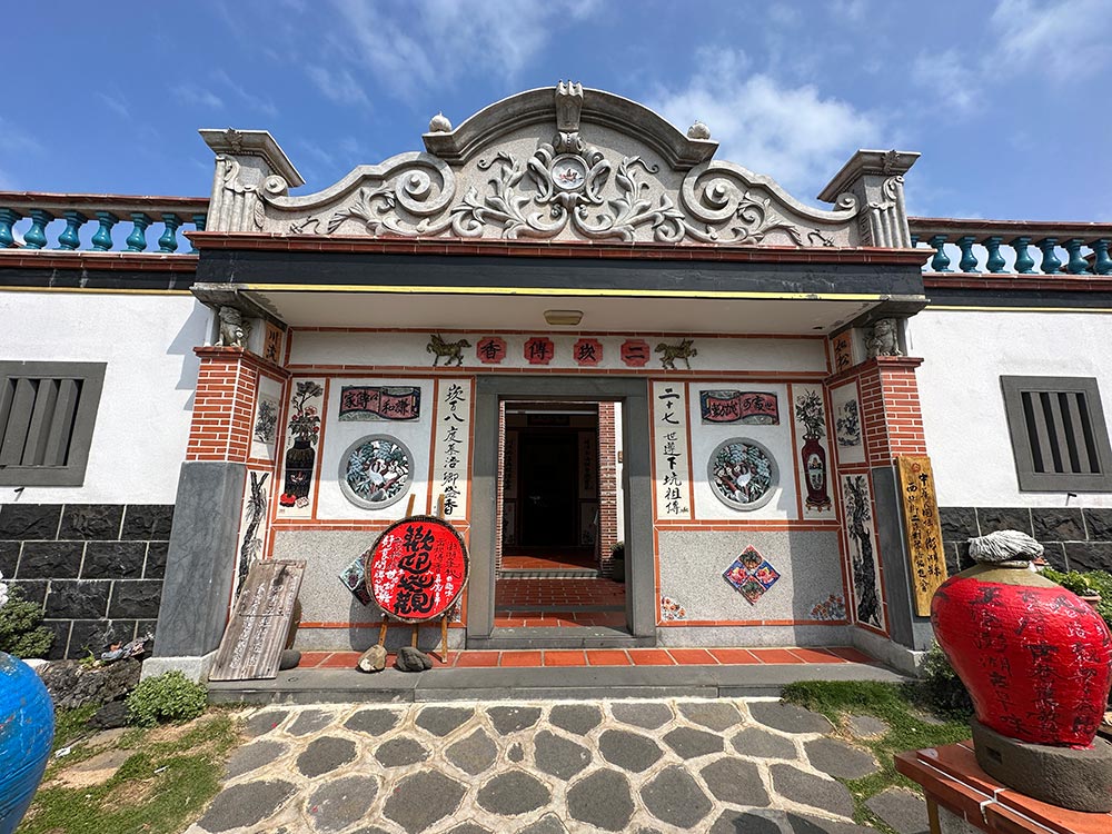
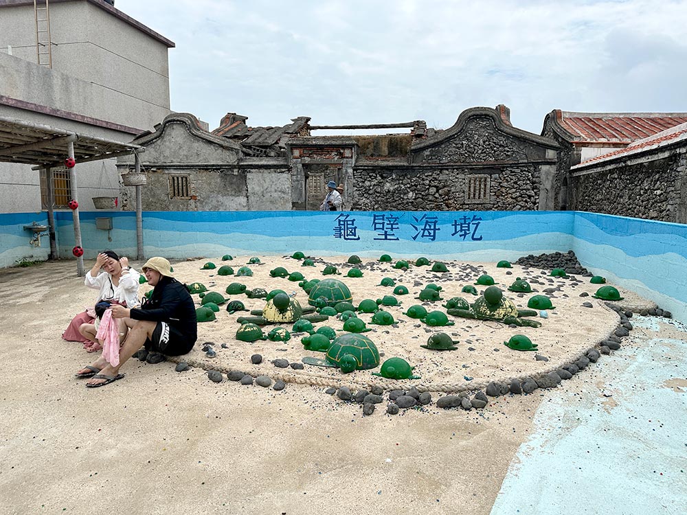
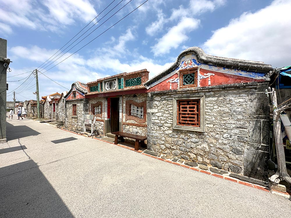
Erkan Historic Village 二崁聚落保存區
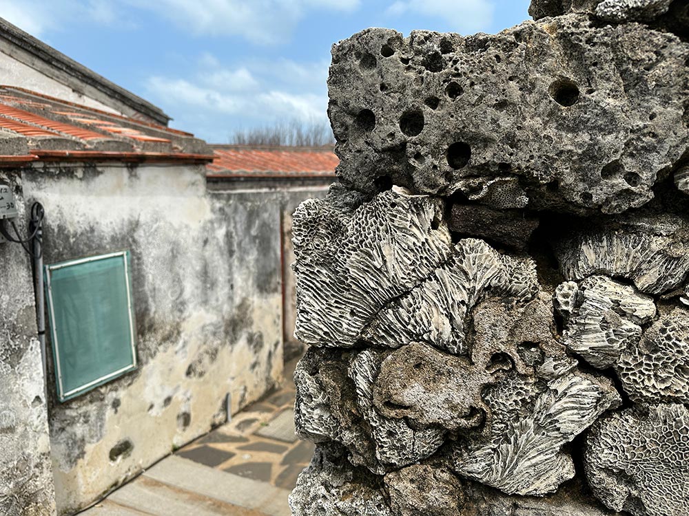
Penghu has several historical villages, but Erkan is probably the most famous of them all. This village has preserved many of the old southern Min-style houses with their slightly upturned roofs that date back up to 300 years! Penghu’s houses are quite unique, featuring walls built of basalt stone and coral because those were the only material easily found on the islands back in the day.
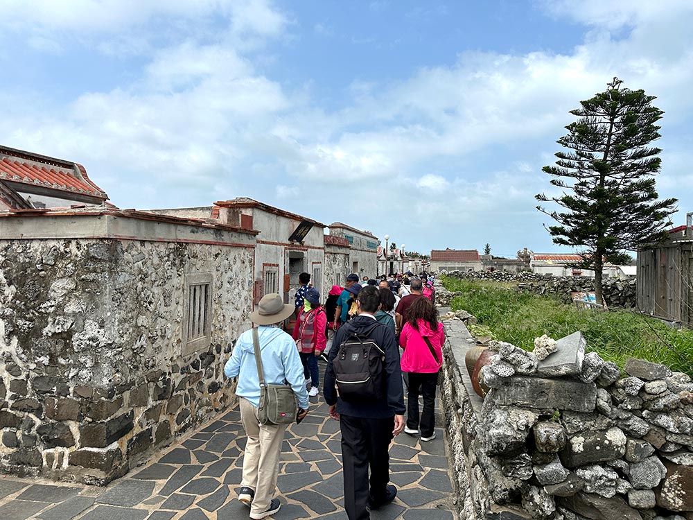
Erkan is nice enough to wander about in, though those narrow lanes can get crowded when the big tourist buses come along. There are some shops around here selling snacks and other souvenirs.
The main house to see is the Chen Family Historical House, you do need to pay an entrance fee to go in, I mostly just enjoyed seeing it from the outside.
Erkan Historic Village 二崁聚落保存區 (Er Kan Ju Luo) [Google maps] There aren’t really any hours but it is still a residential area after all, and the little shops are mostly open only in the afternoons.
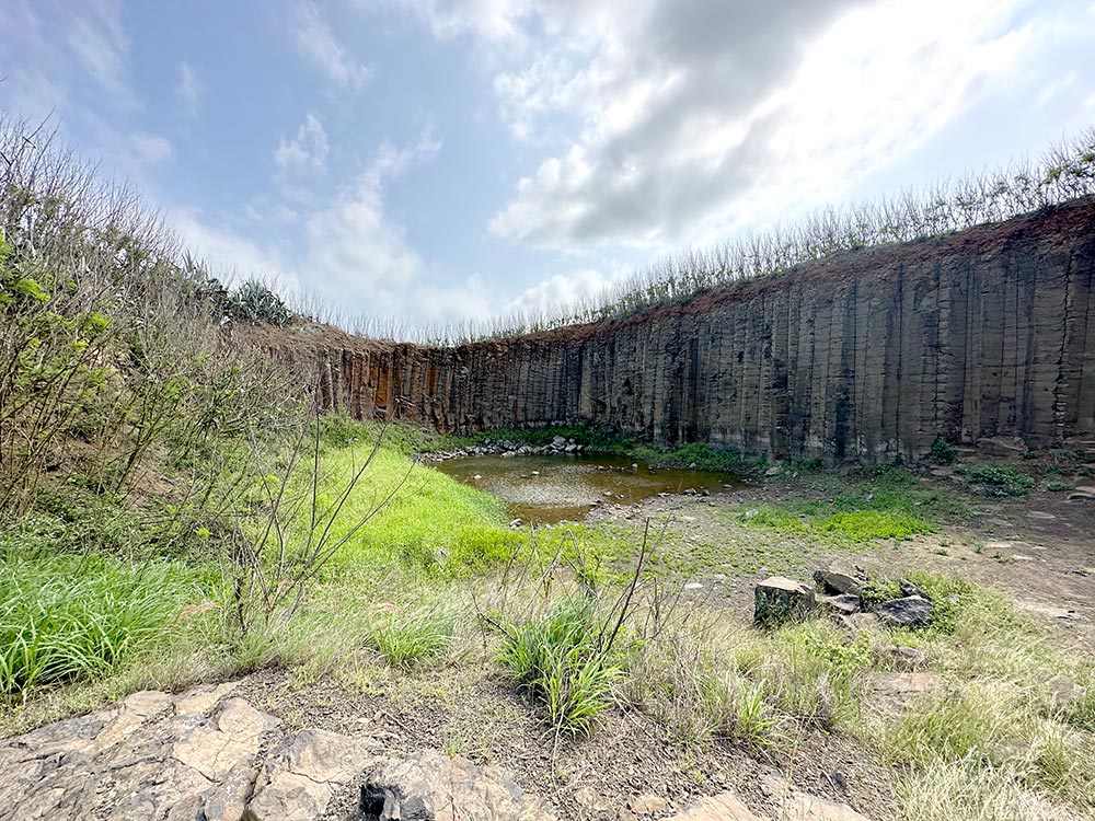
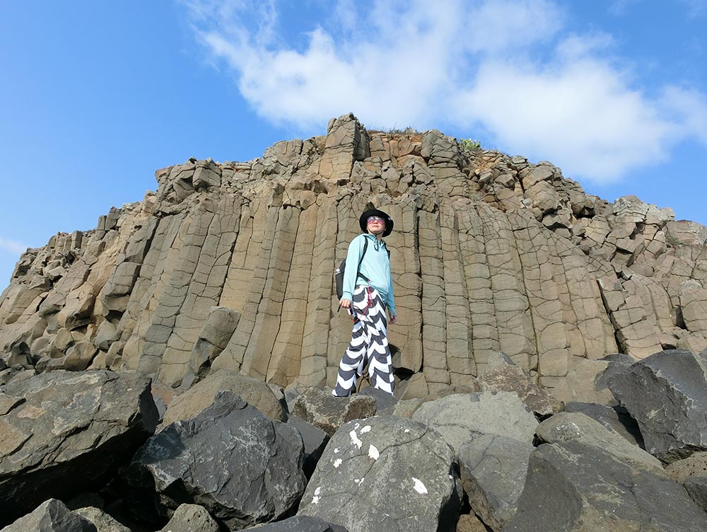
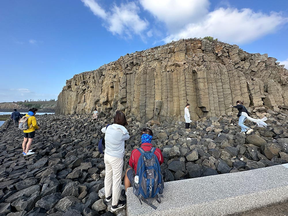
Daguoye Basalt Columnar 大菓葉玄武岩
Not far away from Erkan Village is another famous sight in Penghu, the hexagonal basalt columns formed from volcanic activity. There are several places you can see these basalt columns in Xiyu, and Daguoye is perhaps the most famous of the lot because of its proximity to Erkan Village and its seaside location. These rocks were unearthed when they wanted to build wharf nearby.
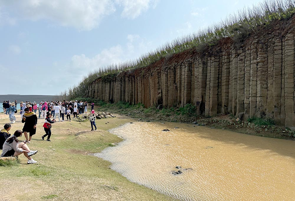
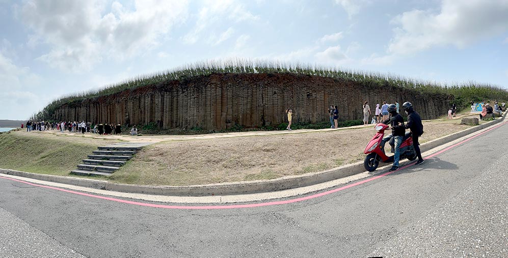
Daguoye has a nice long stretch of basalt columns with a pretty little pool in front of it. Unfortunately when I visited, it was crowded and because of rain/other reasons the pool was kinda murky as well.
Daguoye Basalt Columnar 大菓葉玄武岩 (Da Guo Ye Xuan Wu Yan) [Google maps]
If you are looking for a quieter alternative to see basalt columns, check out Sanshibi just a few minutes away. I wrote about it in my Penghu hidden gems article.
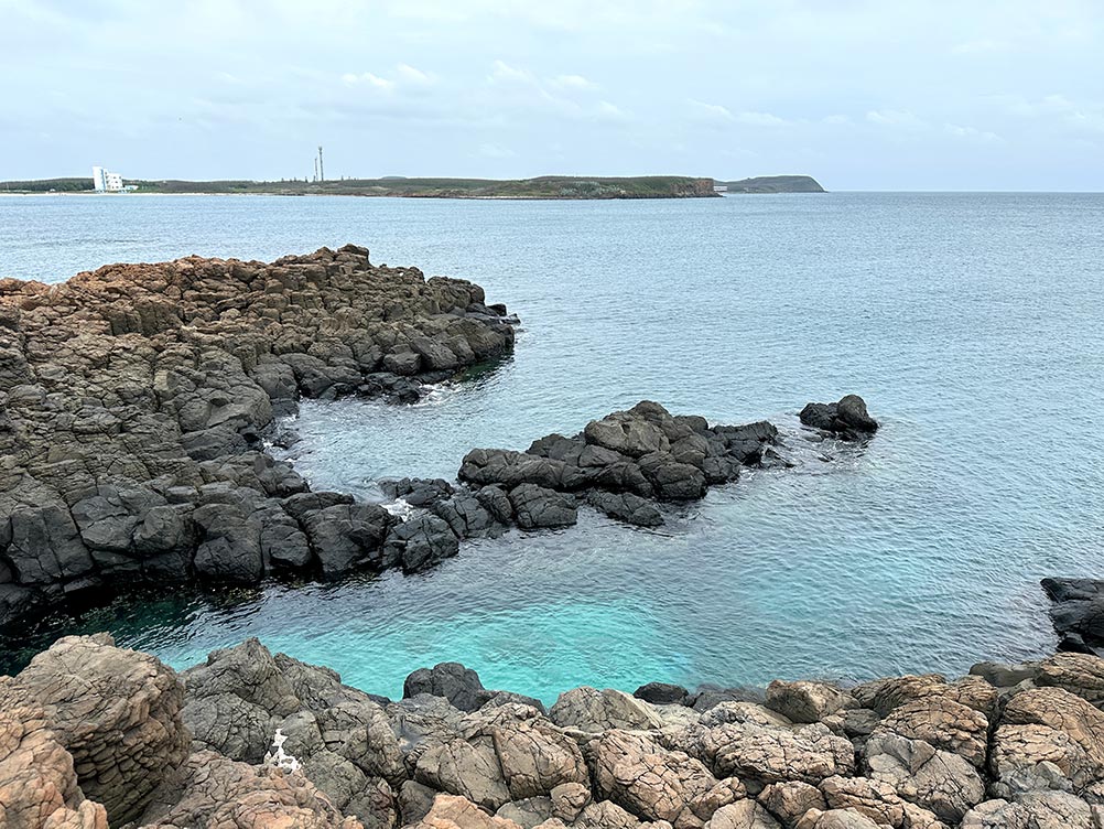
Chixi Rock Waterfall 池西玄武岩
Across the main road from Daguoye, you can pop over to see more basalt columns in a real coastal location at Chixi Rock Waterfall. Personally I think that while this is a smaller stretch of rocks, the view here literally right by the sea is prettier. They call this a rock waterfall as it seems like the rocks are flowing directly into the sea.
There are also some old rock weirs found in the water here. If the water isn’t too rough, you could probably walk out on the weir walls and have a dip here too.
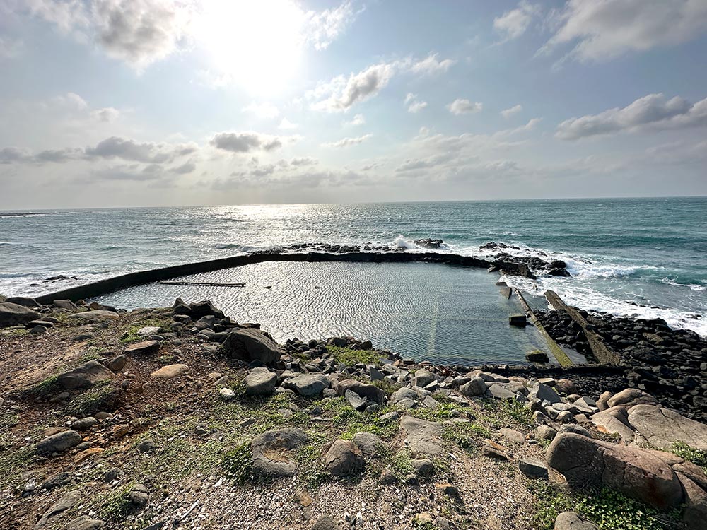
Chixi Rock Waterfall 池西玄武岩 (Chi Xi Xuan Wu Yan) [Google maps]
If you want to see an example of Penghu’s heart-shaped weirs but aren’t planning to go to the famous Qimei double heart version, you can see a single heart version on the other side of the bay at the Chixi Tiger Eye Weir. No raised platforms around here though so you might not get the full effect of the shape from ground level. More on my Penghu Hidden Gems post.

Yuwengdao Lighthouse 漁翁島燈塔
There are a bunch of smaller stops and things to see at the far end of Xiyu Island (Nei’an Beach is pretty, but the weather wasn’t right for beach time when I was there), but to say that you’ve really made it to Xiyu, you have to pop by the Yuwengdao Lighthouse or Fisherman’s Island Lighthouse at the far western end of the island.
There is a small lighthouse there and a nice sea view, and you can check out some of the other nearby sights if you have time before making the long drive back to Magong. There is a small village there called Wai’an where you might be able to grab some food at.
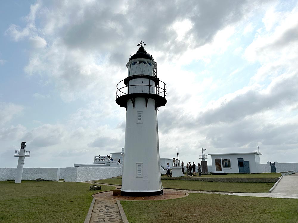
Yuwengdao Lighthouse 漁翁島燈塔 (Yu Weng Dao Deng Ta) [Google maps] Open 9am – 6pm, closed on Mondays.
Day 2: Magong + Huxi 馬公 湖西
Turn your bike eastwards of the main Magong City area for a more indepth exploration of the Huxi island. It will take you less than half an hour to get to the easternmost end of the island from Magong City if you drove non-stop.
Huxi 湖西
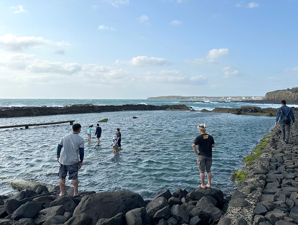
Kuibishan Moses parts the red sea 奎壁山摩西分海
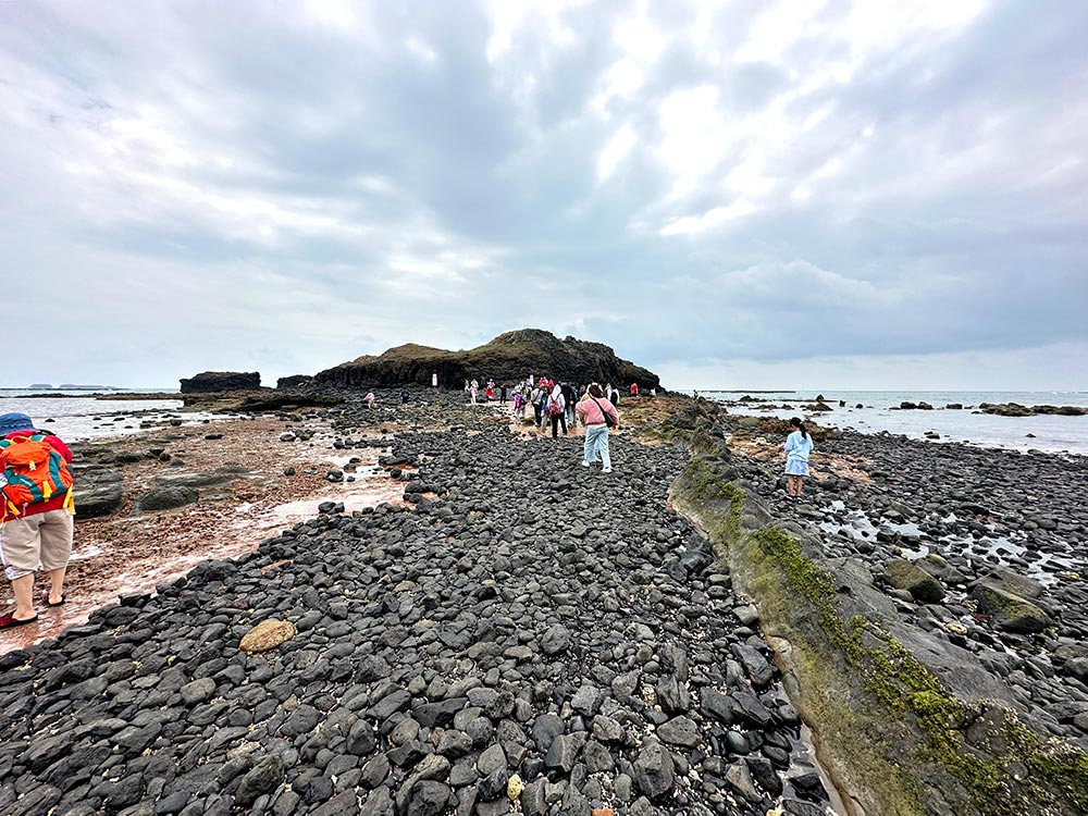
One of Penghu Island’s must-see spots is located at Kuibishan. Known as Moses parts the red sea 摩西分海, low tide reveals a stone path that leads out to the smaller Chiyu island 赤嶼 just off the coastline. The novelty is in being able to walk across this tiny sand bar that only appears twice a day and for a very short time span.
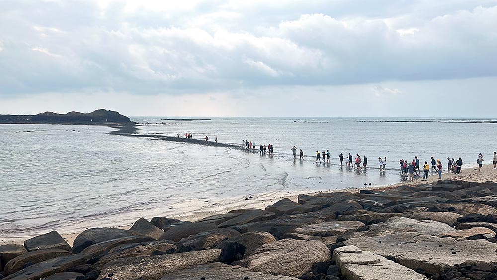
Checking the tide timetable for this spot is essential in planning your itinerary as low tide happens twice a day. My suggestion is to be at the spot at least 30-45 minutes before so you can see the reveal happen for yourself. Crowds also start to build up closer to the lowest tide time.
Staff are on hand to ensure that visitors are safe and don’t try to cross before the tide is low enough. The beach is closed to the public, and only opened by the staff when it’s about time to cross. Intrepid folk will try to be the first ones to cross, but you can afford to wait for a little bit when the tide has properly receded if you don’t want to get your shoes wet at all.
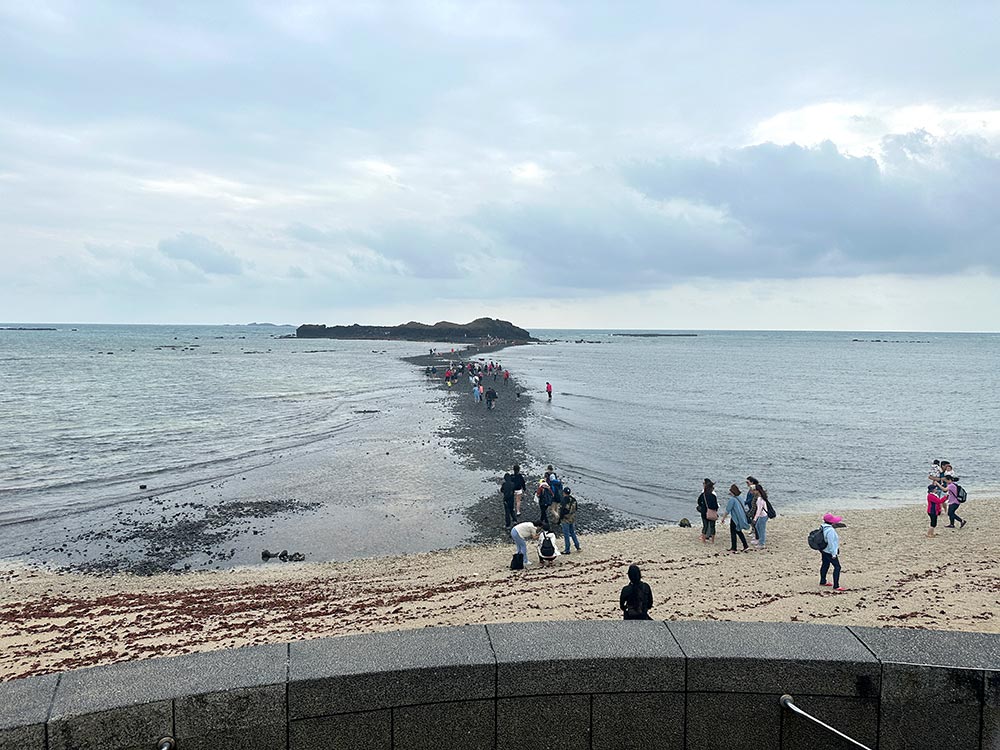
You can walk across the path to Chiyu but people aren’t allowed to walk around Chiyu itself. You have about an hour or so before the staff start herding people back to the shore and the tide rises again, rendering the path invisible quite quickly.
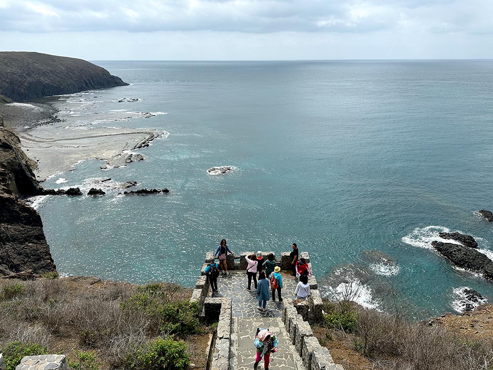
Most tour buses will zoom straight off after the path disappears, but I recommend sticking around and heading over to the actual Kuibi Hill for a short walk. It’s not a difficult climb, but the path around this little hill gives you a nice bird’s eye view of Chiyu and where the path appears, as well as a look at the other low-lying areas that get exposed during low tide like Fanshawei.
Read more over at my post on Hidden gems on Penghu.

Kuibishan Moses parts the red sea 奎壁山摩西分海 (Kui Bi Shan Mo Xi Fen Hai) [Google maps]. Path to Chiyu only opens 2x a day at low tide, dependent on the tides – check the tide schedule before you go if you want to do the crossing.
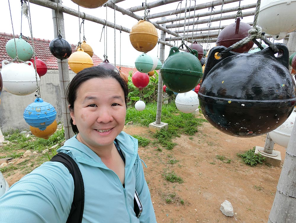
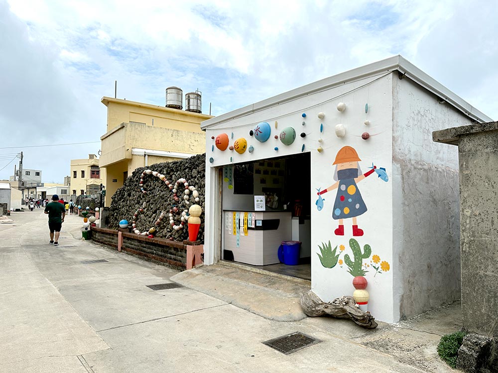
Nanliao Village 南寮
On the way out from Kuibishan, stop over at Nanliao Village. This village was not as popular with fishermen as other villages because of its more inland location, but today they’ve jazzed it up with art installations and murals so it does draw people to wander around its little alleyways for a bit.
My favourite bit is the way that they’ve used the old fishing buoys to create art installations and pretty backdrops! It can get a bit crowded here though. There’s also a lovely old house being strangled by a Banyan tree that’s quite cool to see.
There was also another abandoned house overtaken by a Banyan tree that made for some cool and slightly eerie shots
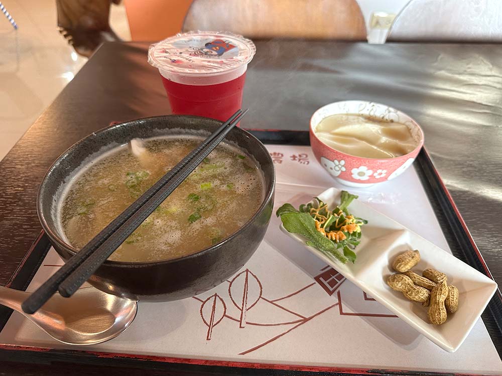
I had lunch at a little eatery here called Nanliao Windmills Reststop and they have a pretty good set meal deal where you can eat the squid vermicelli noodles with cactus juice, tofu and a small side dish.
Nanliao Village 南寮 [Google maps]. You will see the village en route to Kuibishan. Nanliao Windmill Reststop 南寮風車有機農場休息站 [Google maps] is open 8am – 5pm, more on their facebook page.
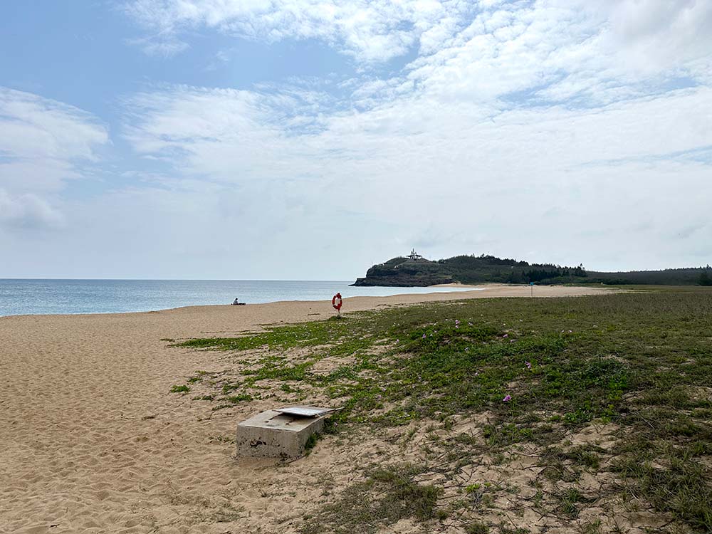
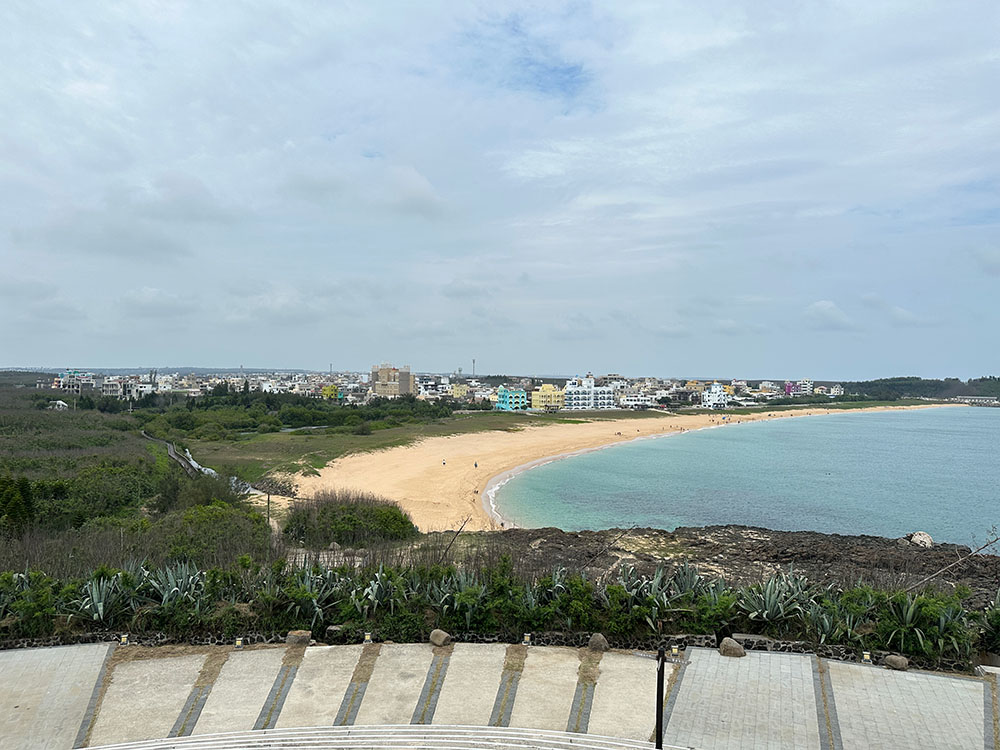
Aimen Beach 隘門沙灘
Located very close to Magong Airport along the eastern shore of the island, Aimen Beach is a popular watersport beach, but it wasn’t that crowded when I visited probably because it wasn’t quite summer time yet. You could also pop by the neighbouring Lintou Beach 林投金沙灘.
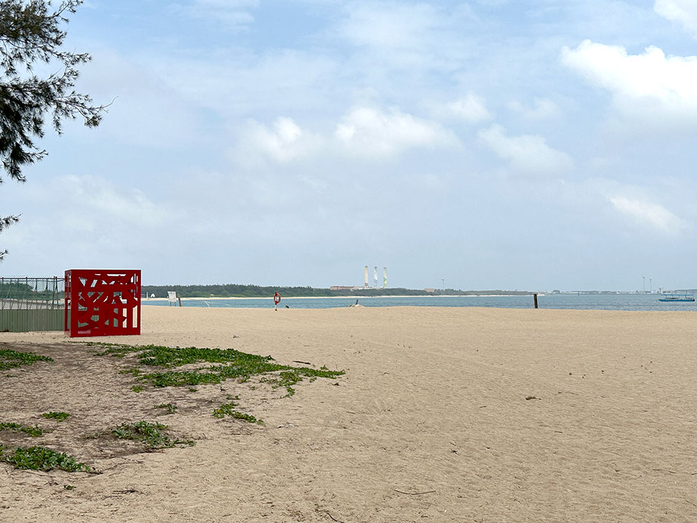
Aimen Beach 隘門沙灘 [Google maps] and Lintou Beach 林投金沙灘 [Google maps]
Sanshui30 Park 山水30公園
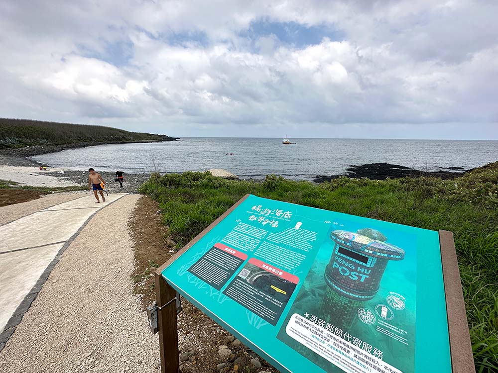
The stretch that links to the southern tip of the island isn’t particularly interesting – I did take a detour along the southeastern coastline where Suogang 鎖港 is located and passed by the spot where the underwater postbox is [Google maps], but obviously you can’t really see much from the surface.
I didn’t have time for this, but you can book on Klook to go snorkelling or scuba diving to see the coral and the underwater postbox. [Klook affiliate links]
Lots of small roads to drive around in this area. Eventually I found myself at Sanshui Beach which is supposed to be quite a popular beach too. From there I spotted Sanshui30 Park in the distance and made my way to this little lookout point. There is a small pavilion and remains of a bunker here, as well as a nice panoramic view of the beach below.
Sanshui30 Park 山水30公園 [Google maps] is located on the western end of Sanshui Beach 山水沙灘 [Google maps]. This is a small town with a number of guesthouses and an alternative place to stay if you don’t want to stay in the main Magong City area.
Fongguei Cave 風櫃洞
Heading to the southwestern tip of the island, I passed by yet another cute Shili Beach 嵵裡沙灘. I’d intended to head to Snakehead Park 蛇頭山遊憩區 (She Tou Shan) but unfortunately the roads were closed for maintenance, so I found myself at Fongguei Cave instead.
These are more basalt rocks along the shoreline, but apparently what makes this special is that there’s supposed to be a blowhole that makes a rather musical whistling sound here. Maybe it’s a matter of tide timing, but there was no wave action nor sounds happening when I visited, so I mostly just enjoyed the view.
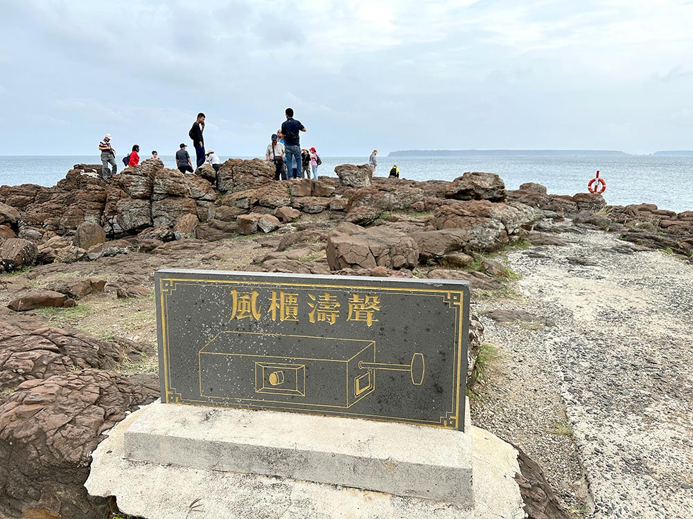
The other thing to do here is snap that IG shot at the mushroom-shaped Youfu Pavilion 幽浮涼亭. Yes, it was pretty crowded, but you do get a nice view from the higher platform.
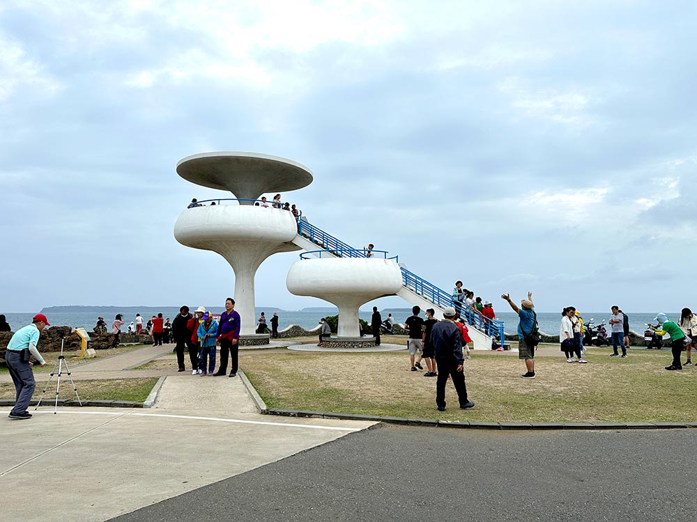
Fongguei Cave 風櫃洞 (Feng Gui Dong) [Google maps]
Magong City 馬公市
After exploring these bits, it’s time to head back to the main Magong City area.
Guanyinting 觀音亭親水遊憩區
Back near the port, Guanyinting is a nice little seaside park where you can see and take a walk over the arched Xiying Rainbow Bridge 西瀛虹橋 which is lit up like a rainbow at night. The bridge was closed when I visited because of the fireworks festival – fireworks are released from the bridge itself, but the park is a nice place for a walk or swim in the day time. Lots of sports facilities around here and people jogging and playing sports in the evening.
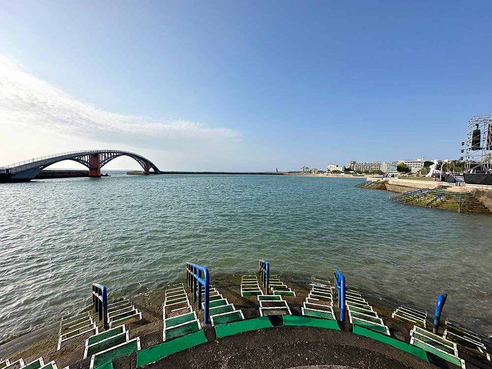
You can also find a Guanyin temple in this park – that is how it got its name after all. The original temple was built in the late 1600s, but it was destroyed in a war with France and this current version was rebuilt in the late 1800s.
Read my detailed post about the Penghu Fireworks Festival.
Guanyinting 觀音亭 [Google maps] is open 24 hours
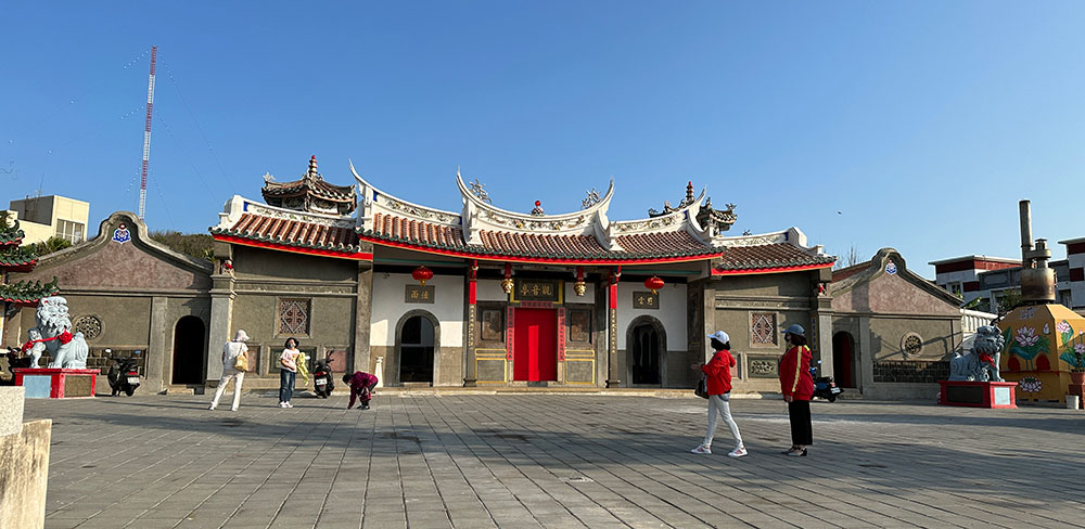
Penghu Tianhou Temple 澎湖天后宮
This unassuming little temple in Magong City is apparently the oldest Mazu Temple in all of Taiwan, dating back to 1604! It may be small but it’s got lovely decorations and not a bad place to pop by
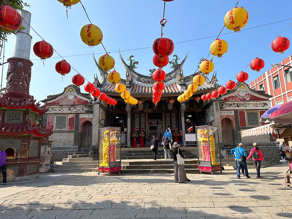
Penghu Tianhou Temple 澎湖天后宮 [Google maps] Open 7am – 7pm.
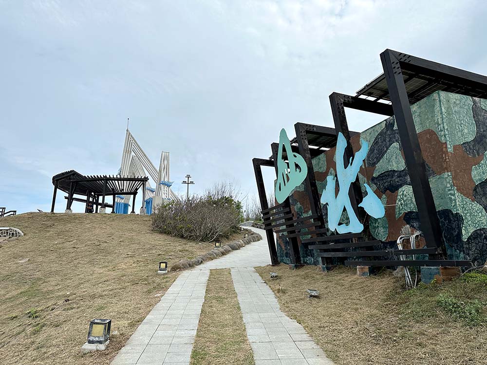
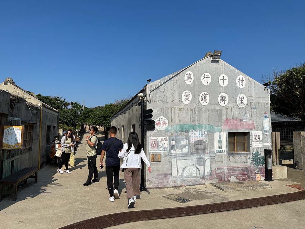
Duxingshi Village 篤行十村
Not far away from the Nanhai port is Duxingshi village, perhaps the oldest military living quarters in Taiwan. Once headquarters to Penghu’s military, it became home to the soldiers and their families stationed in Penghu when the Chinese Nationalist Party (KMT) first arrived in Taiwan.
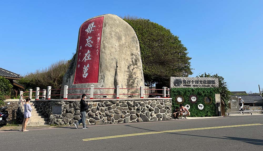
These old Japanese-style military quarters have been transformed into a cultural village with little shops, galleries and museums, including permanent exhibitions to two famous Taiwanese singers who grew up here. It’s a nice place to wander around for an hour or two with lots of cute little photo spots.
You can also check out the Jingguitou Fortress at the tip of the island. There are some disused military tunnels and domed barracks that you can wander around a bit here. It’s west-facing direction also makes it popular for sunset photos.
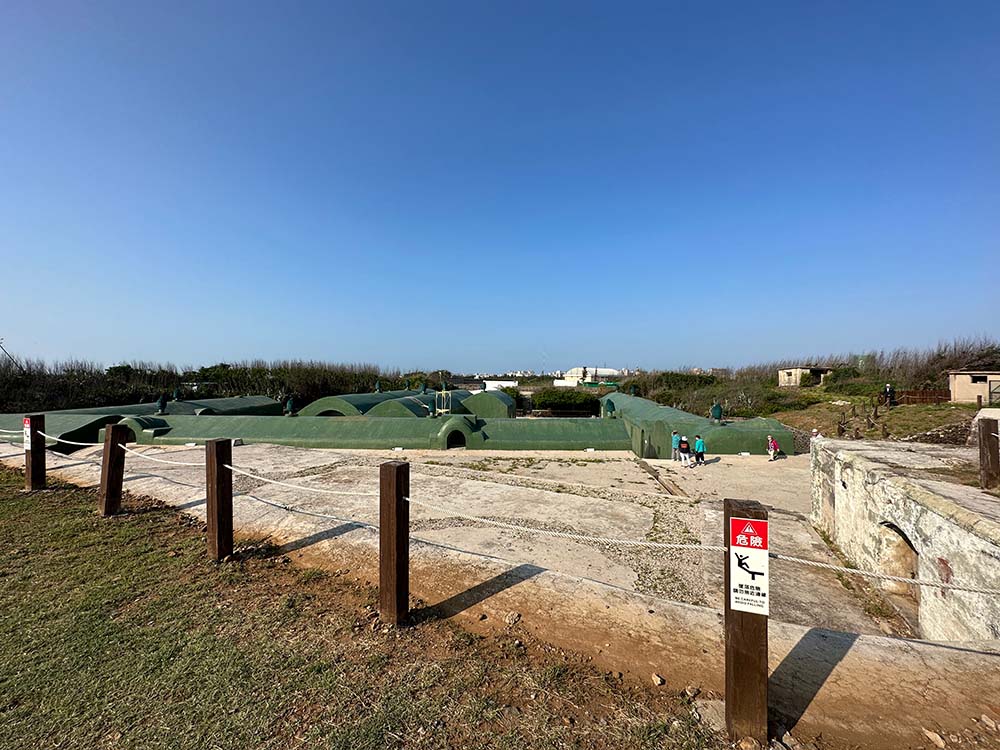
Duxingshi Village 篤行十村 (Du Xing Shi Chun) [Google maps] Open 8am – 930pm. More on their website.
Mazu Statue 重光媽祖銅像
The district I stayed in Penghu (Siwei) is more residential compared to downtown Magong City, but I was quite surprised to spot this very large Mazu statue not far away on my daily commutes.
It was only later that I realised that this is apparently now the tallest Mazu statue in the world at 48m high, but also a very new attraction – they officially opened it about 5 months after I visited! There has been some controversy about this according to some news articles I read – this statue was apparently part of plans to build a Mazu theme park that had been scrapped.
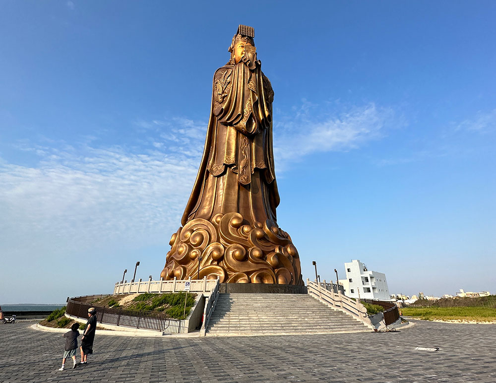
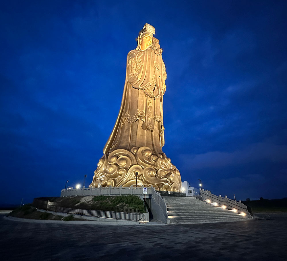
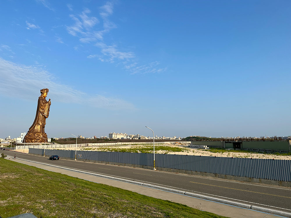
Mazu Statue 重光媽祖銅像 (Chong Guang Ma Zu Tong Xiang) [Google maps]
Some food recs
Penghu has its signature foods to check out. As a solo traveller, getting to eat everything you want can always be challenging, but I did manage to eat some local delicacies, and here are some of the places I recommend eating at.
23.5º Cactus Ice Cream 掌上明珠
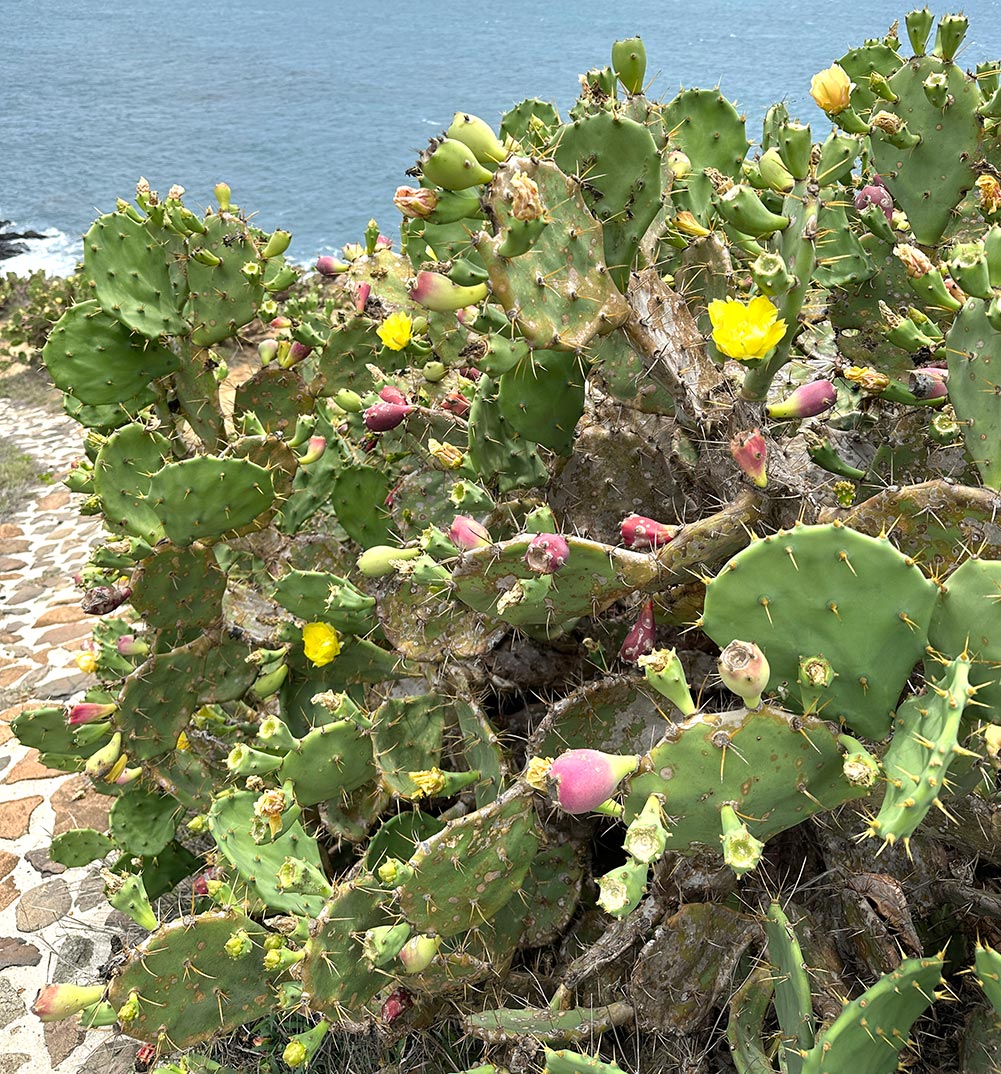
Cactus ice cream is a must-have in Penghu – the Elephant Ear Prickly Pear Cactus 紅蘋果仙人掌 is one of the few plants that survives Penghu’s rather harsh weather and windy conditions, and it’s most popularly used to make ice cream these days. It’s a lovely bright vibrant purplish-pink (similar to dragonfruit!) and is sweet and tasty.
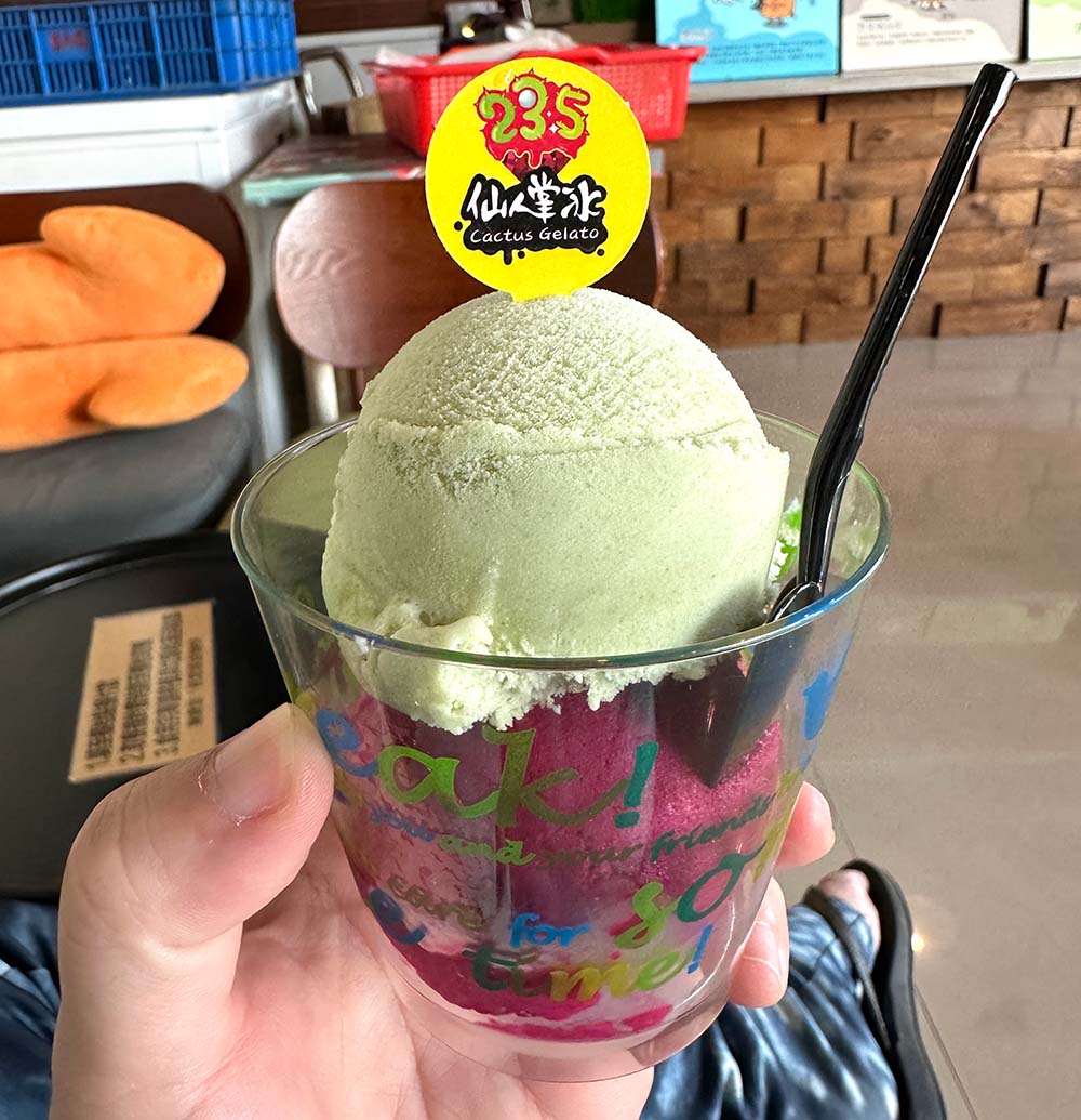
23.5º Cactus Ice Cream 掌上明珠. Open daily 1pm – 730pm. More on their website. When I visited, they had a location in Calamari Hostel near the Nanhai Harbour area, but that seems to be temporarily closed and they have another location a little bit further north.
A Bao Sausage Stall 阿豹香腸攤
If you’re a fan of Taiwanese sausage, you’ll enjoy this little sausage stall which reminds me of loklok? Basically you just point out what you want. Besides the normal sausage and the rice sausage, they also had oden and you can help yourself to freeflow soup too.
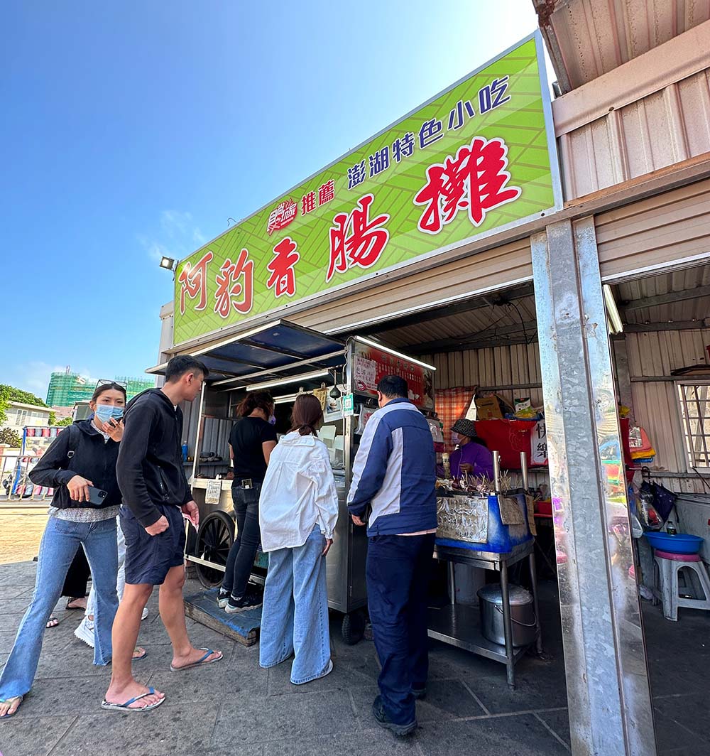
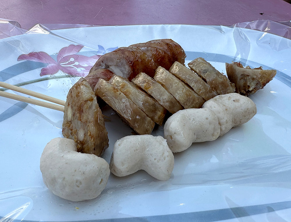
A Bao Sausage Stall 阿豹香腸攤 [Google map] Open 12pm – 8pm (720pm Mon/Wed, 11pm Fri), closed on Tuesdays. More on their Facebook page.
Penghu Laojia Jianbing 澎湖老家餡餅
I chanced upon this stall on the same evening as the fireworks show, and you know it’s popular because there was a 2+ hour waiting time, good golly! Luckily since I only wanted one piece, the lady boss took some pity on me and gave me one of the beef-cheese jianbings that she just fried up. Woohoo! Anyway it’s the perfect savoury snack~
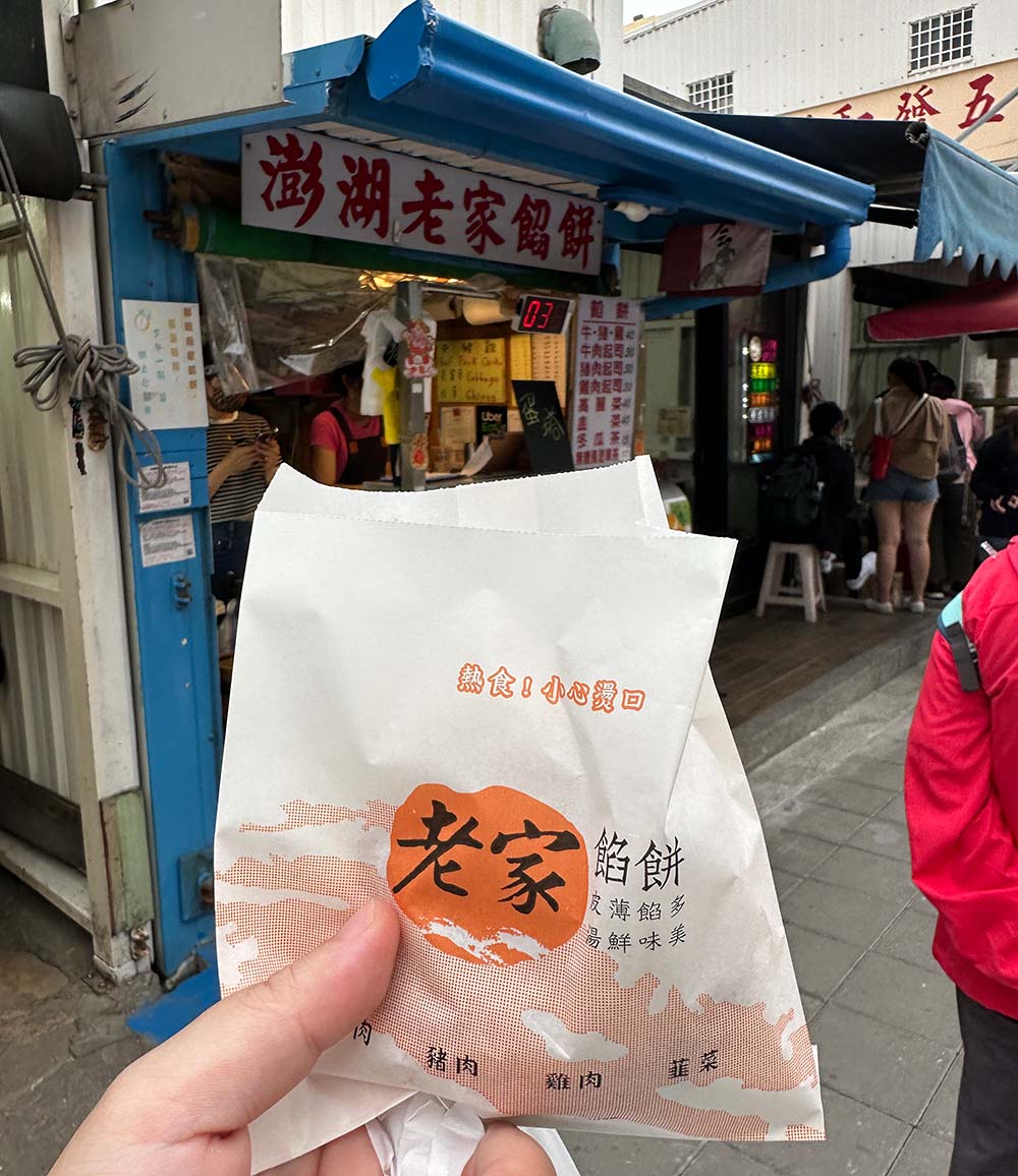
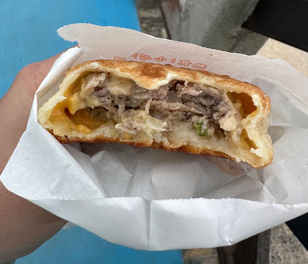
Penghu Laojia Jianbing 澎湖老家餡餅 [Google map] Open daily 1pm – 730pm. More on their Facebook page.
Day 3: Qimei + Wang’an 七美 望安
You’ve seen most of the main island, now it’s time to venture out on a day trip to see more of Penghu’s smaller islands! There are several islands that you can visit, but Qimei is one of the more popular options because of the famous Double Heart Stone Weir.
Wang’an is the 2nd stop in this day trip as it is located about halfway between Magong and Qimei.
Qimei-Wang’an boat day trip
The easiest way to see Qimei and Wang’an is to take a boat day trip – the boat journeys are covered, as well as scooter rental on the islands itself. If you don’t plan to ride, there are chartered coaches that will take you to the major sights on the islands.
The trip itinerary:
- Meet at Magong Nanhai Port 740am to register for the boat
- Boat leaves Magong Nanhai Port at 8am
- Boat reaches Qimei Nanhu Port at 9am, about 2 hours to explore, leave at 11am
- Boat reaches Wang’an at 1130am, 2 hours to explore, leave at 130pm
- Boat reaches Magong Nanhai Port at 2pm
A note that the scooter rentals included in the boat ticket are calculated for 2 people sharing a single scooter – there is an additional single supplement for solo folk who have no pillion riders. I think it’s dumb, but it is what it is~
Qimei 七美
Qimei is one of the southernmost islands in the Penghu archipelago and one of the few Penghu islands you can take an internal flight to. If you don’t want to take a looong boat ride to get there, you can fly from Magong Airport to Qimei Airport (CMJ) in the northwest corner of the island.
Qimei’s Nanhu Port 南滬港 is on the southern tip of the island and it takes just 10 minutes to drive to the northeastern tip of the island whether the stone weir is. THAT’s exactly how small this island is! I drove around the island in a clockwise direction.
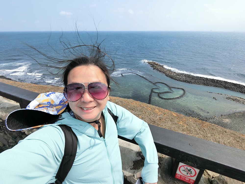
Double Heart Stone Weir 雙心石滬
Stone weirs are a traditional way to catch fish by trapping them in a shallow coastal pool, but this particular one in Qimei became famous because it has a very distinctive double heart shape and is used in most of Penghu’s promotional material.

You don’t actually get to go down to the stone weir itself – the path takes you to a look out point on the cliff overlooking the stone weir so you can only see it from above. The weather was lovely and clear that day so the colours of the sea were pretty amazing when the sun was out.
Since this is THE sight to see on Qimei, all the tour buses stop here and it gets super crowded, but just be a bit patient and you can score a nice spot along the wall for a good picture.
Double Heart Stone Weir 雙心石滬 (Shuang Xin Shi Hu) [Google maps]
Little Taiwan 小台灣
A short drive away from the famous Twin Heart Stone Weirs on the east coast of Qimei is a slightly less popular rock known as the Little Taiwan rock because… it looks like the shape of Taiwan on a map. Similarly this is a lookout spot and not a rock you can actually walk to directly.
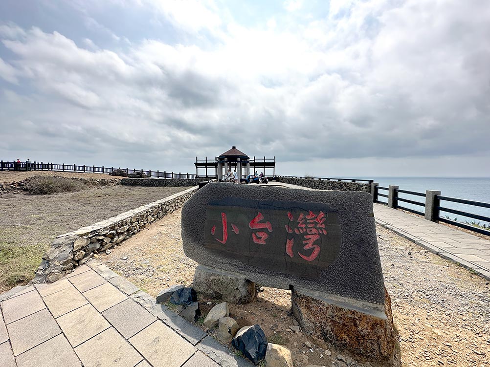
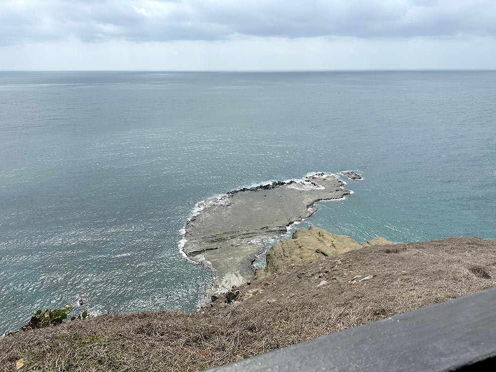
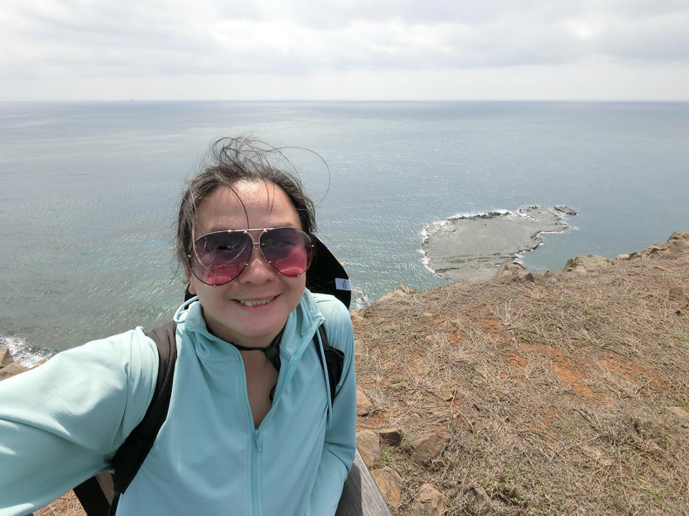
Little Taiwan 小台灣 (Xiao Tai Wan) [Google maps]
Shishi Scenic Area 石獅風景區
The Shishi or Stone Lion scenic area on the southeastern side of Qimei has some lovely views of geological rock features – the main highlight is of course the stone lion (which… doesn’t look particularly like a lion anymore imo). There was a small market when I visited where you could pick up some local food and souvenirs.
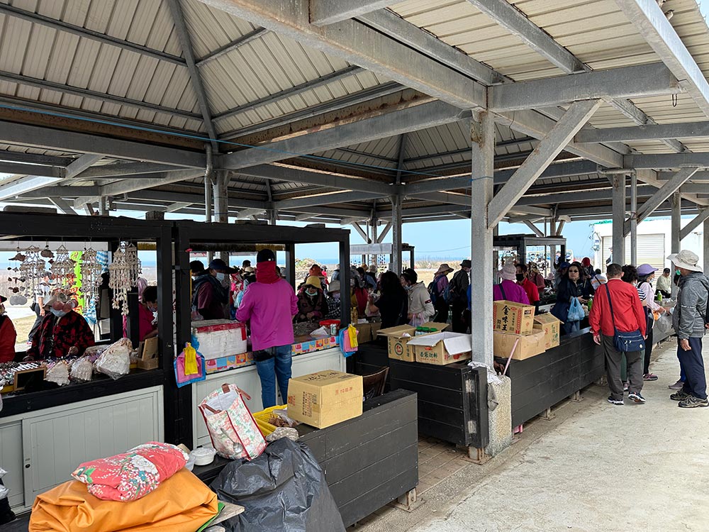
Shishi Scenic Area 石獅風景區 [Google maps]
Apo Meat Dumpling 七美芳子肉粽
I was hungry at this point and decided to stop by this little shop that was recommended to me by my guesthouse lady called A Po meat dumpling. Glutinous rice stuffed with pork and doused in gravy makes for a pretty yummy lunch break.
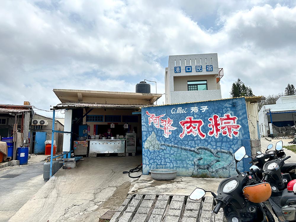
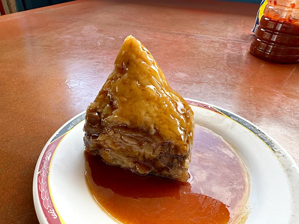
Apo Meat Dumpling 七美芳子肉粽 [Google maps] Open 530am – 130pm
Wang’an Island 望安
Next stop, we backtrack our way to Wang’an Island. The port is on the southeastern side of the island and I made my way anti-clockwise around the island. I did pop by the Yuanyang Hole and Longdong Cliff along the way but didn’t find them particularly interesting.
Xidongwei Tower 西洞尾燈塔
I found this particular tower in the middle of nowhere on the western outskirts of Shui’an Village. Apparently it once functioned as a lighthouse but is no longer in use, but even so it’s a pretty unconventional lighthouse.
Xidongwei Tower 西洞尾燈塔 [Google maps]
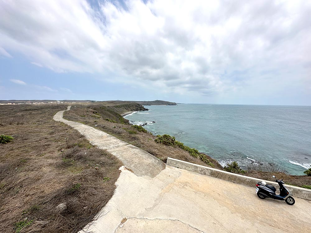
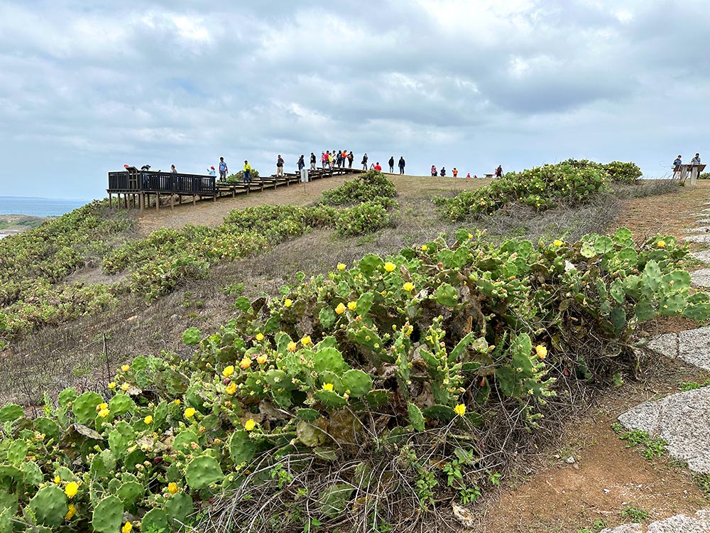
Tiantai Hill 天台山
The most popular viewpoint on Wang’an Island is Tiantai Hill. There’s a nice boardwalk and lookout area to see the sea as well as lots of Penghu’s famous cactii growing all around.
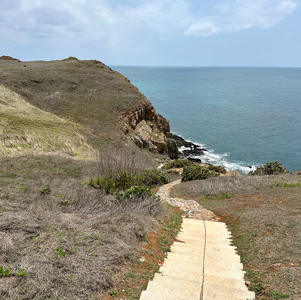
If you’re feeling strong, take a walk down the paved path towards the coastline where you can see the eroded coastline and caved. I was in flipflops so I passed on this!
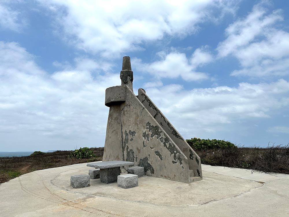
More bizarre is this particular rock with a ‘footprint’ indentation said to be created by one of the legendary 8 immortals Lu Dong Bin. Dude apparently really needed to answer the call of nature and with no toilet around, set his foot on this rock on Tiantai Hill to do his business.
I swear I’m not making this up, that’s what it says on the signs here!
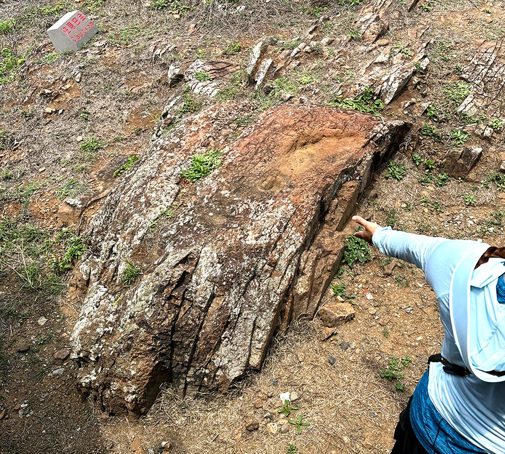
Tiantai Hill 天台山 [Google maps]
Huazai Village 花宅聚落
On the western end of Wang’an island is a small village with old Penghu houses. Known as Huazai Village or Zhongshe village, it’s a nice place to wander around in for awhile though some of the buildings have been abandoned and left in pretty ramshackle condition. Lots of cats here too!
Huazai Village 花宅聚落 [Google maps]
Things to do in future
It seems like I’ve done a lot, but there’s still quite a lot more of Penghu that I want to see if I get the chance to go back in future.
- Enjoy Penghu’s beaches and water sports – I need to go when it’s warmer!
- Visit the other islands – Jibei and its triple-heart stone weir and Hujing are 2 of Penghu’s other islands that I want to visit
If you’re looking or more tips on the Penghu Islands, check out my Penghu planning post for tips on transport and accommodation, or my Penghu Hidden Gems post for some alternatives to the hotspots.
